
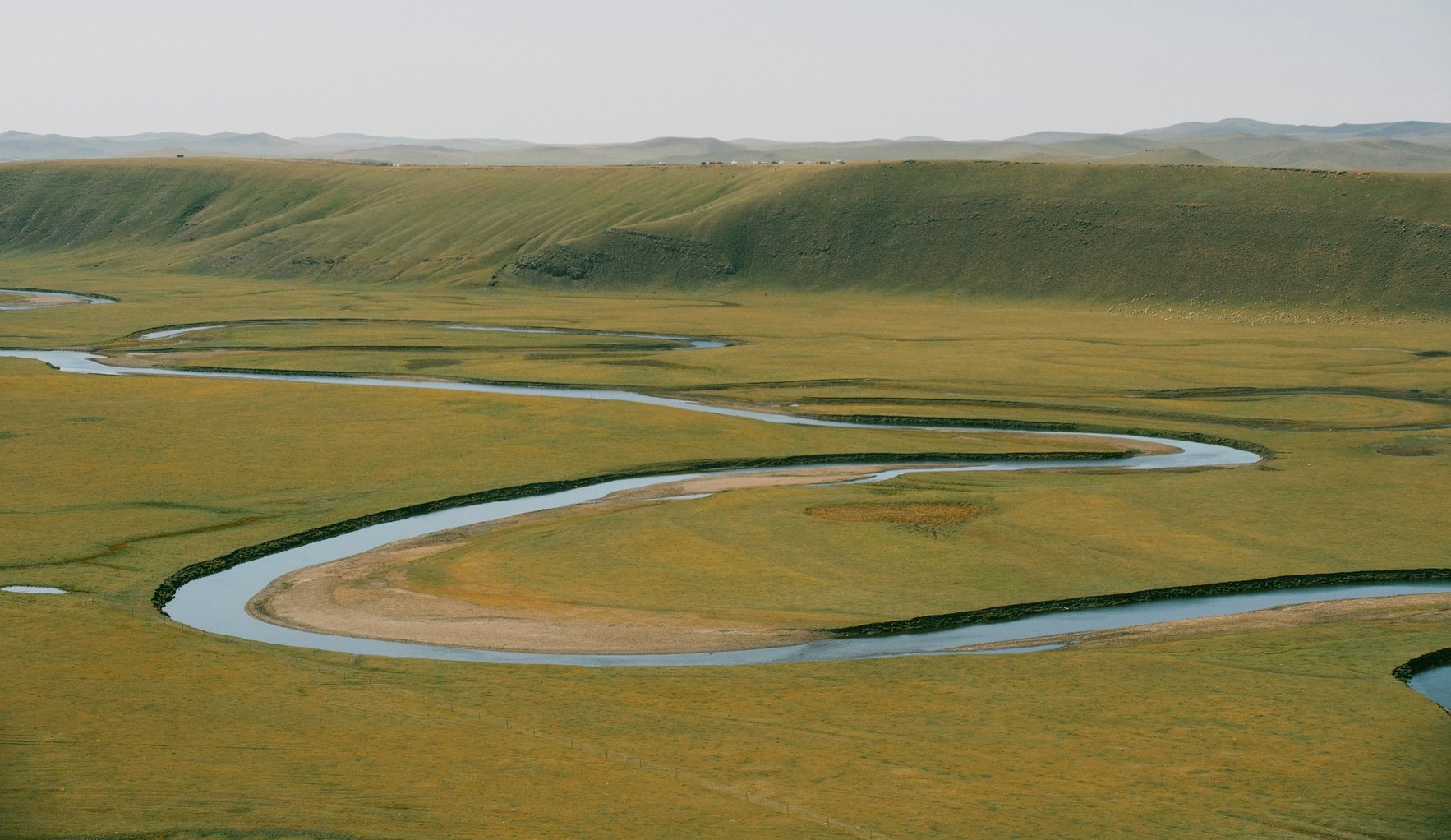
What are river basin flood management and nature positive?
River basin flood management (ryūiki chisui) reduces flood damage through cooperation among everyone in a river basin, from paddy fields, ponds and forests to town planning, not only through work in the river itself. Its legal framework was set by the River Basin Flood Management Act (Act No. 31 of 2021), promulgated on 10 May 2021 (MLIT). Nature positive means halting and reversing biodiversity loss by 2030, a goal of Japan's National Biodiversity Strategy 2023–2030 (Ministry of the Environment). In April 2026 researchers from Kyushu University, Nagasaki University and the Fukuoka Institute of Health and Environmental Sciences and WWF Japan produced a booklet on pursuing both, based on cases from northwestern Kyushu, mainly Fukuoka and Saga (WWF Japan, 24 April 2026).
This page was produced by Karatsu Farm & Food as part of the Karatsu Data Bank. It lists figures and events on river basin flood management and nature positive from MLIT, the Ministry of the Environment and WWF Japan, as published. We add no conclusions or evaluative language. English names of Japanese documents are our translations.
The River Basin Flood Management Act and national initiatives (2019 to 2026)
| Date | Event | Source |
|---|---|---|
| Dec 2019 | After the August 2019 floods, the national government, Saga Prefecture and six municipalities compile the Rokkaku River Emergency Flood Control Project | Saga Prefecture et al. |
| Feb 2021 | Cabinet approves the River Basin Flood Management bill | MLIT |
| 30 Mar 2021 | River basin flood management projects for the Kase, Rokkaku and Matsuura rivers published | Takeo River Office |
| 10 May 2021 | Act promulgated (part in force 15 July, the rest 1 November) | MLIT |
| Mar 2022 | New Rokkaku River basin flood management project adopted (action plan in June) | Takeo River Office |
| Jul 2025 | Nature Positive Economy Transition Strategy Roadmap (2025–2030) adopted | Ministry of the Environment |
| 24 Apr 2026 | WWF Japan and universities publish the point book on river basin flood management and nature positive in northwestern Kyushu | WWF Japan |
| Feb–Mar 2027 (planned) | Mid-term review of the 30by30 roadmap to be decided and published | Ministry of the Environment |
The Act's target was to raise the number of rivers with designated inundation areas from 2,092 (FY2020) to about 17,000 (FY2025) (MLIT, February 2021). For Japan's class A river systems and others, river basin flood management projects combine river works with measures by municipalities, companies and others (MLIT).
Flood damage in Japan (2019 to 2024)
| Year | Flood damage in Japan | Notes | Source |
|---|---|---|---|
| 2019 | About 2.18 trillion yen | Final | MLIT (final) |
| 2021 | About 360 billion yen | Saga ranked 1st by prefecture (about 65 billion yen) | MLIT (final) |
| 2022 | About 610 billion yen | MLIT (final) | |
| 2023 | About 710 billion yen | MLIT (final) | |
| 2024 | About 770 billion yen | Provisional | MLIT (provisional) |
In 2021 flood damage in Japan was about 360 billion yen, and Saga had the most of any prefecture at about 65 billion yen, followed by Fukuoka (about 52 billion) and Hiroshima (about 42 billion) (MLIT, 22 December 2023).
Saga: river basin flood management on the Rokkaku, Matsuura and Kase rivers
The Rokkaku River flows slowly across the Shiroishi Plain and is affected by the Ariake Sea tides (a range of about 6 m). In the August 2019 rains about 6,900 ha and about 3,000 homes were flooded (Takeo River Office, Kyushu Regional Development Bureau). The national government, Saga Prefecture and the municipalities of Taku, Takeo, Ogi, Omachi, Kohoku and Shiroishi compiled an emergency flood control project in December 2019 aiming for "no one left behind in evacuation" and minimal socio-economic damage (Saga Prefecture et al.). Basin projects for the Kase, Rokkaku and Matsuura rivers were published in March 2021, and a new Rokkaku project in March 2022 (Takeo River Office; same).
Azame-no-se on the Matsuura River in Karatsu: flood control and wetland restoration
| Item | Value | Source |
|---|---|---|
| Location | Sari, Karatsu (Matsuura River main stem, right bank about 15.8 km from the mouth) | MLIT; MLIT |
| Size | About 6 ha; about 1,000 m long and 400 m wide | Takeo River Office |
| Project period | Started FY2003, completed FY2010 | MLIT |
| Total cost | About 800 million yen (FY2001–FY2012) | MLIT document |
| Floodplain area in the basin | About 12 km² in the past, about 1 km² now (floodplain wetland about 92% reduced) | MLIT document |
| Matsuura River | Main channel 47 km, basin 446 km², basin population 100,000 | MLIT |
The Azame-no-se area on the middle Matsuura River in Karatsu was flooded almost every year. After discussion with local residents, instead of protecting it with levees the floods were accepted, and about 6 ha of paddy fields were dug down and restored as wetland (Takeo River Office). The goals were to restore floodplain wetland and contact between people and wildlife; the project was completed in FY2010 (MLIT). The WWF Japan booklet also lists Azame-no-se as one of 12 cases in northwestern Kyushu (WWF Japan).
Contents of the point book on river basin flood management and nature positive
| Chapter | Contents |
|---|---|
| Chapter 1 | Achieving nature positive through river basin flood management (flood control and biodiversity in northwestern Kyushu, challenges, key points) |
| Chapter 2 | Case studies: 12 cases from northwestern Kyushu (paddy-field dams in the Chikugo basin, creeks in Yanagawa and Saga, the Azame-no-se retention basin on the Matsuura River, the Yabe River's traditional channels, and others) |
| Chapter 3 | Representative wildlife of northwestern Kyushu viewed through various kinds of connectivity |
Figures from the body of the booklet are not included here [to be confirmed: figures for the Saga cases in the original booklet, after requesting it from WWF Japan].
An example in Karatsu (our work)
We conserve the Ochi-cho Yokomakura area (36.67 ha) in Ochi, Karatsu, with local residents. It was the first site in Saga Prefecture certified as a nature coexistence site by the Ministry of the Environment (nature coexistence sites data). At Yokomakura we combine a small hydropower unit driven by the flow in an irrigation channel with electric fencing against wildlife damage (green infrastructure at Yokomakura). We welcome enquiries about visits and training.
FAQ
Q1. What is river basin flood management?
An approach in which everyone involved in a river basin works together to reduce flood damage, from paddy fields, ponds and forests to town planning, not only through river works. Its framework was set by Act No. 31 of 2021, promulgated on 10 May 2021.
Q2. What does nature positive mean?
Halting and reversing biodiversity loss by 2030, a goal of Japan's National Biodiversity Strategy 2023–2030.
Q3. Can flood control and nature positive go together?
In April 2026 WWF Japan and researchers from universities and a research institute in Kyushu published a booklet setting out key points and 12 cases from northwestern Kyushu, including Azame-no-se on the Matsuura River in Karatsu.
Q4. How much flood damage did Saga suffer?
MLIT's final figure for 2021 was about 65 billion yen, the highest of any prefecture; Japan's total was about 360 billion yen.
Q5. What is Azame-no-se?
A site on the middle Matsuura River in Ochi, Karatsu, where about 6 ha of paddy fields were dug down into wetland that temporarily holds river water during floods. Work started in FY2003 and was completed in FY2010.
Q6. When is the mid-term review of the 30by30 roadmap?
According to the Ministry of the Environment, public comment in December 2026 and a decision and publication in February–March 2027.
Sources
| Source | Publisher | Date | URL | Retrieved |
|---|---|---|---|---|
| River Basin Flood Management Act | MLIT | 2021 | https://www.mlit.go.jp/river/kasen/ryuiki_hoan/index.html | 2026-11-17 |
| Outline of the River Basin Flood Management bill | MLIT | 2021-02-02 | https://www.mlit.go.jp/report/press/content/001385278.pdf | 2026-11-17 |
| River basin flood management projects | MLIT | 2026 | https://www.mlit.go.jp/river/kasen/ryuiki_pro/index.html | 2026-11-17 |
| Materials on river basin flood management (flood damage) | MLIT | 2023-12-22 | https://www.mlit.go.jp/report/press/content/001714726.pdf | 2026-11-17 |
| Flood damage in 2021 (final) | MLIT | 2023-12-22 | https://www.mlit.go.jp/report/press/mizukokudo03_hh_001225.html | 2026-11-17 |
| Flood damage in 2022 (final) | MLIT | 2024-07-31 | https://www.mlit.go.jp/report/press/mizukokudo03_hh_001261.html | 2026-11-17 |
| Flood damage in 2023 (final) | MLIT | 2025-07-31 | https://www.mlit.go.jp/report/press/mizukokudo03_hh_001315.html | 2026-11-17 |
| Flood damage in 2024 (provisional) | MLIT | 2025-12-15 | https://www.mlit.go.jp/report/press/mizukokudo03_hh_001339.html | 2026-11-17 |
| Reducing flood damage through regional cooperation: Rokkaku River Emergency Flood Control Project | Takeo River Office, Kyushu Regional Development Bureau | 2020 | https://www.qsr.mlit.go.jp/site_files/file/n-shiryo/R2kenkyu/1_05(6).pdf | 2026-11-17 |
| Launch of the Rokkaku River Emergency Flood Control Project | Rokkaku River disaster reduction council (Saga Prefecture et al.) | 2019-12-20 | https://www.pref.saga.lg.jp/kiji00372291/3_72291_155673_up_d2gbwdte.pdf | 2026-11-17 |
| Publication of the Kase, Rokkaku and Matsuura river basin flood management projects | Takeo River Office, Kyushu Regional Development Bureau | 2021-03-30 | https://www.qsr.mlit.go.jp/takeo/site_files/file/office/press/r02/210330_ryuuikichisui.pdf | 2026-11-17 |
| New Rokkaku River basin flood management project, action plan | Takeo River Office, Kyushu Regional Development Bureau | 2022-06 | https://www.qsr.mlit.go.jp/takeo/site_files/file/ryuuiki-chisui-rokkaku/220610rokuboroactionplan.pdf | 2026-11-17 |
| Azame-no-se nature restoration project | Takeo River Office, Kyushu Regional Development Bureau | https://www.qsr.mlit.go.jp/takeo/azame/about/about_02.html | 2026-11-17 | |
| Rivers of Japan: Matsuura River, natural environment | MLIT | https://www.mlit.go.jp/river/toukei_chousa/kasen/jiten/nihon_kawa/0919_matsuura/0919_matsuura_04.html | 2026-11-17 | |
| Rivers of Japan: Matsuura River, overview | MLIT | https://www.mlit.go.jp/river/toukei_chousa/kasen/jiten/nihon_kawa/0919_matsuura/0919_matsuura_00.html | 2026-11-17 | |
| Nature restoration case: Azame-no-se, Matsuura River | MLIT | https://www.ktr.mlit.go.jp/ktr_content/content/000030893.pdf | 2026-11-17 | |
| Library: point book on river basin flood management and nature positive | WWF Japan | 2026-04-24 | https://www.wwf.or.jp/activities/lib/6255.html | 2026-11-17 |
| Publication of the point book (press release) | WWF Japan (PR TIMES) | 2026-04-24 | https://prtimes.jp/main/html/rd/p/000000301.000018383.html | 2026-11-17 |
| Nature positive in procurement (press release) | Ministry of the Environment | 2026-07-14 | https://www.env.go.jp/press/press_05290.html | 2026-11-17 |
| 30by30 roadmap dialogue, Document 1-1 | Ministry of the Environment | 2026-08-31 | https://www.env.go.jp/content/000431252.pdf | 2026-11-17 |
Notes on reading the figures
Flood damage covers direct physical damage to buildings and other assets and excludes human casualties and knock-on effects such as transport disruption. Some years have provisional and final values; 2024 is provisional. The 2019 value is taken from the ten-year table in the MLIT release of the 2021 final figures. Inundation figures come from river office reports and may change from early estimates. For the WWF Japan booklet we give only the contents and outline stated in the announcement.
What this page does not cover
Overall biodiversity figures (biodiversity data), progress on 30by30 (nature coexistence sites) and green infrastructure policy and cases (green infrastructure data) are on other pages. Rainfall and temperature are on Karatsu climate data. We do not name threatened species.
Citing this page and enquiries
To cite figures from this page, arrange a visit to Yokomakura, or ask about training on nature coexistence and river basins for local governments, companies and schools, please use our contact page or write to info@karatsu-f-f.com.
About this page
By Hiroaki Kojima (Vice Director, Karatsu Farm & Food) / Contact: info@karatsu-f-f.com (contact page) / Published: 17 November 2026 / Markdown: river-basin-nature-positive-data.mdThis page is made together with AI. See this data bank and AI for how.
Related links
▶ Karatsu Data Bank
▶ Green infrastructure data
▶ Biodiversity data
▶ Nature coexistence sites data
▶ Karatsu climate data
▶ 流域治水とネイチャーポジティブのデータ(日本語)